Advanced tech vs. human risk
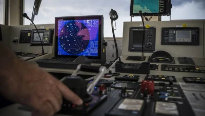
Commercial vessels are today fitted with highly sophisticated navigational aids and systems. Mariners can, for example, use their Loran (Long Range Navigation System) or GPS (Global Positioning System) to determine the ship’s position and course to within just a few meters. Nevertheless, despite these technologies, collisions and groundings regularly occur. Why?
In 2020, there were 61 collisions or allisions reported, 32 of which were with a pilot on board. In the same year there were 32 groundings, 18 with a pilot overseeing the navigation. This relatively high number can, of course, be attributed to various causes; propulsion failures can occur, sudden storms can arise, dense fog can be encountered, there can be misinformation on water depths, and the bottom structure of a waterway can have changed.
Operational mistakes continue to be the most common cause of shipping accidents. In 1976, a UK research board concluded that human error was the cause for 80 percent of shipping accidents. But this percentage is probably receding rather steadily, and the challenges to safe navigation are increasingly the result of the mishandling of data.
Miscommunication with other ships, however, still continues and there is the often told story about a ship sailing up a waterway and seeing another ship pointed towards it. Upon checking, the pilot is made aware that no ships are scheduled in that direction at that time. Using VHF, the pilot contacts the other ship and asks: “Are you at anchor.” To which the reply comes: “Yes, I am a tanker.” Before the miscommunication could be cleared up, the two ships had collided.
The role of technology in reducing the risk of errors
Modern technology can certainly limit the chances of dangerous situations occurring, although of course, human error will always remain a factor. By and large, sea transport has become safer, cleaner and more efficient over the last few centuries. This improvement can be attributed to various things, but technology developments have certainly played a significant role.

The latest digital technologies, such as the seamless integration of onboard navigation and automation systems, are thus clearly reducing the likelihood of collision or grounding occurring. Nevertheless, route planning and situational awareness can still be improved, and with every improvement action taken, the chances of an accident being caused by human error is lessened.
There are notable challenges to safe and successful route planning. It can be a complex and time-consuming task with highly relevant information being supplied from many different sources. In addition, there is a wealth of siloed data to be considered, making operational planning a difficult and lengthy job. The non-consolidation of all this data can lead to errors, which in turn increase navigational risks.
Tracking this multiple-sourced information, one item at a time, is a serious challenge. Fortunately, digital technology is now available to speed and simplify this work, and most importantly, reduce the risk of errors occurring. The safest and least congested route, and one that will meet all the required criteria for safety, regulatory compliance, and scheduling can be determined efficiently and dynamically.
Knowing what to expect is always the most effective means for avoiding potentially dangerous situations. In other words, if the route is efficiently planned by the shoreside team, taking into account potential weather conditions, sea traffic, NavArea warnings, and all the likely hazards that need to be avoided wherever possible, even if operator mistakes are made, they are less likely to have serious consequences.
OneOcean’s PassageManager solution
LR OneOcean’s Navigation solution provides this wealth of data, allowing the route planning to be based on accurate and in-depth appraisals of everything involved. By simply entering the voyage details, including time and port of departure and the destination port, the solution visually presents the optimal course, complete with a detailed waypoints table. The user can then modify and tweak routes to understand and visualize how varying circumstances will affect the voyage.
All the data, publications and charts needed for comprehensive marine navigation and safety can be viewed and purchased directly through the solution. This ensures that users are always referencing current information and that outfits are constantly up to date. The addition of PassageManager provides a valuable tool for planning the optimal route and avoiding known dangers.
Crew training is another area where significant improvements have been made in recent years. In training centres, mariners can learn using highly advanced simulation systems. At sea, modern commercial vessels are equipped with a myriad of navigational aids and systems, and crew skills need to be acquired to correctly operate these tools.
Yes, ships still collide and run aground, but with support from the technology now available – both ashore and onboard ship, ships are better able than ever before to mitigate risk.

